Latest Journal News
    Iranian Journal of Geology ( Scientific )
  • Published Issues

    OpenAccess
  • About Journal

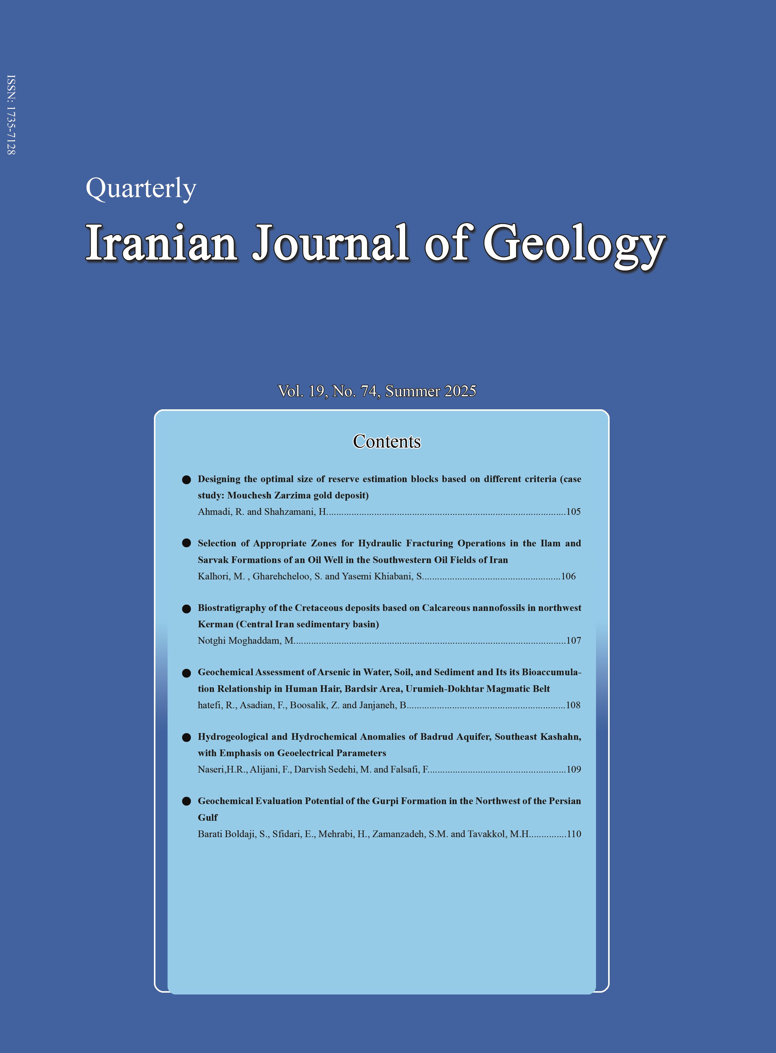
    Iranian Geological Quarterly

    Recent Articles

    • Open Access Article

      1 - Genesis of Dochileh copper deposit, east of Mayamey; based on geological, mineralogical and geochemical constraints
      Mahboobeh Zafarzadeh F. Mousivand Ramzan Ramzani Umali Amir Mahdavi
      Issue 64 , Vol. 16 , Winter 2023
      Dochileh copper deposit is located 72 km east of Shahrood, 15 km east of Mayamey, in North Central Iran volcanic belt. The stratigraphic sequence of the region comprises a considerable amount of volcanic and volcanic-sedimentary deposits of Eocene. these deposits are More
      Dochileh copper deposit is located 72 km east of Shahrood, 15 km east of Mayamey, in North Central Iran volcanic belt. The stratigraphic sequence of the region comprises a considerable amount of volcanic and volcanic-sedimentary deposits of Eocene. these deposits are locally covered by Neogen and Quaternary deposits. The volcanic rocks hosting mineralization are composed of different rocks including basalt, andesite basalt and trachy andesitebasalt rocks that often contain plagioclase and clinopyroxene phenocrysts. The copper mineralization mostly occurred along the faults and fractures with the dominant trend of NW-SE in the basaltic rocks as vein-veinlets and open space fillings. Ore minerals including primary native copper and hematite, and secondary minerals such as malachite, goethite, hematite. gangue minerals such as calcite, zeolite and analcime. The wallrock alterations in the host rocks include chloritic, carbonatic, analcime-zeolite and iron oxide. The oxidation of mafic minerals such as pyroxene and magnetite were responsible for copper reduction and hematitic alteration. Geochemical investigation indicates that amounts of Cu and Ag are up to 5.11 wt% and 7.8 ppm, respectively. According to field studies, mineralogy and alteration, the Duchileh copper deposit appears to be formed during diagenesis and burial metamorphism, and dominantly during the orogeny and uplift processes, due to enterance of hot ore fluids along the fractures and faults perpendicular to the fold axis. The Duchileh deposit have a large resemblance to the basaltic copper or Michigan-type copper deposits in terms of tectonic setting, host rock, mineralogy, metal content, alteration and ore controls. Manuscript profile

    • Open Access Article

      2 - Geology, mineralization and fluid inclusion studies of the Lakhshak gold deposit, southwest Sistan suture zone
      N.  Heydarian Dehkordi S. Niroomand Hossein Ali Tajeddin رضا  نوزعیم
      Issue 64 , Vol. 16 , Winter 2023
      Lakhshk deposit is located 28 km northwest of Zahedan and southwestern of Sistan suture zone. The main outcrops in the study area are Eocene schists consisting of calc-schist and quartz schist. These rocks metamorphosed under greenschist facies grade and were intruded More
      Lakhshk deposit is located 28 km northwest of Zahedan and southwestern of Sistan suture zone. The main outcrops in the study area are Eocene schists consisting of calc-schist and quartz schist. These rocks metamorphosed under greenschist facies grade and were intruded by Oligocene rhyolitic and dacitic dikes and granitoid. The gold-antimony mineralization is structurally controlled by a NE–SW fault zone and shear zone, and hydrothermal alterations were mainly occurred in the contact zones of granitoid and calc-schist units. The high-grade gold mineralization (3.5 g/t) is spatially related to the intense sulfidation and silicification hydrothermal alteration zones in the inner parts of the zone as well as ductile-brittle (microfractures, fine veins/veinlets) deformation. The ore mineralogy is simple and includes pyrite, arsenical pyrite, stibnite, chalcopyrite, arsenopyrite, pyrrhotite, sphalerite, gold, electrum, goethite, and stibiconite. The study of fluid inclusions on gold ores quartz shows the homogenization temperature in quartz-sulfide veins/veinlets with mineralization between 200 to 330 °C with a salinity of 8 to 13 wt.% NaCl equiv., which is compatible with the mixing and dilution process. Based on the results of geology, mineralogy, and fluid inclusion studies, gold mineralization in Lakhshak gold deposit is of orogenic type. Manuscript profile

    • Open Access Article

      3 - Global record of oceanic anoxic event in the carbonates of the Daryian Formation in the northern High Zagros, Zargran mountain (Gadvan)
      Mazaher Yavari M. Yazdi Hormoz Ghalavand Mohammad Hossein Adabi
      Issue 64 , Vol. 16 , Winter 2023
      The recording of oceanic anoxic event al record and the time of this event in the shallow carbonates of the Dariyan Formation in Zargran mountain (Gadvan) section in the east of Shiraz, was studied based on carbon and oxygen isotopes, microfacies and fossil data. More
      The recording of oceanic anoxic event al record and the time of this event in the shallow carbonates of the Dariyan Formation in Zargran mountain (Gadvan) section in the east of Shiraz, was studied based on carbon and oxygen isotopes, microfacies and fossil data. In this section, thickness of the Dariyan Formation is 287 m and 191 samples were taken. Based on field data, the sedimentary sequence of this formation, , begins at the base with thick-layered to massive gray limestones containing orbitolinas and rudists, and in the upper parts it includes medium to thick-layered gray limestones including abundant benthic foraminifera, such as orbitolinas. In the mentioned section, based on the study of the embryonic cells of orbitolinas, a late Barmian-early Aptian age was determined for the lower part of this unit, which is the beginning of the formation of anoxic oceanic deposits. The carbon isotope curves between the C3 and C6 curves in the carbonates at the base of the Daryian Formation show disturbances. These changes and the appearance of the Lithocodium-Bacinella facies in this part of the formation confirm the existence of an oceanic anoxic event. The oceanic anoxic event indicates warming of the environment and greenhouse conditions, which was accompanied by abundant rudists in this section and can be a confirmation for the weather conditions of this event. Manuscript profile

    • Open Access Article

      4 - Determination of formation temperature, oxygen fugacity and Ce4+/Ce3+ ratio with using zircon chemistry in the pegmatitic dikes of Malayer-Boroujerd-Shazand, Sanandaj-Sirjan zone
      Majid Ghasemi siani
      Issue 64 , Vol. 16 , Winter 2023
      The Granitoid plutons in the Sanandaj-Sirjan zone host numerous pegmatitic dikes. This study is focused on mineral chemistry of zircons in the pegmatite dikes in the Malayer, Boroujerd and Shazand district to evaluate zircon crystallization temperature, oxygen fugacity More
      The Granitoid plutons in the Sanandaj-Sirjan zone host numerous pegmatitic dikes. This study is focused on mineral chemistry of zircons in the pegmatite dikes in the Malayer, Boroujerd and Shazand district to evaluate zircon crystallization temperature, oxygen fugacity and Ce4+/Ce3+ ratio and also zircon/rock partition coefficients of REEs and U, Th, Ta, Nb and Y. Trace element discrimination digrams such as Th versus Y and Yb/Sm versus Y and Nb, indicated studied zircons were located in the syenite pegmatite field. Zircon/rock partition coefficients indicate that zircon granis are enriched in the HREE than LREE. Zircon chemistry show that zircon in the Shazand and Malayer pegmatite dikes have more Hf and less REE distribution than zircons in the Boroujerd pegmatite dikes. Consequently, it indicates the role of latter hydrothermal process in the formation of Boroujerd zircons. Crystallization temperature, oxygen fugacity and Ce4+/Ce3+ ratios decrease from Malayer to Shazand and finally Boroujerd pegmatite dikes. Reduced condition of magmatism, Th/U contents below 1 and Y/Ho content higher than 20 indicate that these pegmatities are barren. Manuscript profile

    • Open Access Article

      5 - Extraction effect of deep and semi-deep wells on water table decline and groundwater qaulity parameters in Gorgan Plain
      M. Pakdel M. G.Mahmoodlu N. Jandaghi A. Fathabadi Y. Nick Ghojogh
      Issue 64 , Vol. 16 , Winter 2023
      The present study was conducted to investigate the effect of increasing uncontrolled drilling of water wells and subsequent extraction of renewable capacity of Gorgan plain aquifer on the decrease in groundwater level and some water quality parameters in a specific peri More
      The present study was conducted to investigate the effect of increasing uncontrolled drilling of water wells and subsequent extraction of renewable capacity of Gorgan plain aquifer on the decrease in groundwater level and some water quality parameters in a specific period of 30 years. For this purpose, the trend of rainfall changes, drilling wells, groundwater level fluctuations, as well as some physicochemical parameters were investigated in the studied period. Data analysis of variance was used to investigate the statistical differences between quantitative and qualitative parameters. The annual changes in drilling of authorized and illegal wells in the province shows an increasing trend in the number of wells drilled in the Gorgan plain, followed by an increase in the volume of water extracted since the early 1980s. The results of statistical studies, histograms of annual changes in groundwater level of deep and semi-deep wells as well as hydrographs of deep and semi-deep aquifers studied show a reduction in groundwater level in both semi-deep and deep aquifers in the study period. Since the average annual rainfall in the study period is almost constant, the drilling of shallow and deep wells followed by uncontrolled abstraction of deep and semi-deep aquifers is the most likely major factor in the decline of groundwater levels in the study plain. Based on the statistical results, a significant difference was observed between most of the physicochemical parameters of semi-deep and deep wells in the old and new periods. However, these changes are greater in semi-deep wells than the deep ones. Also, the two parameters Cl and Na, which are the main factors of water salinity, show the greatest changes. Hydrogeochemical diagrams of plain aquifers show an increase in soluble solids as well as changes in the type and hydrochemical facies of groundwater in the new period. However, the trend of changes in the shallow aquifer is more intense. Manuscript profile

    • Open Access Article

      6 - Estimation of grain size curve of surface coarse sediments using imaging system designed
      A.H. Tabee A. Karami – Khaniki A.A. Bidokhti K. Lari
      Issue 64 , Vol. 16 , Winter 2023
      Sediment recognition is one of the basic topics in coastal and river engineering. One of the parameters of sediment identification is their grain size. To determine the grain size, traditional methods such as sieving the sediments are usually used, which is accurate More
      Sediment recognition is one of the basic topics in coastal and river engineering. One of the parameters of sediment identification is their grain size. To determine the grain size, traditional methods such as sieving the sediments are usually used, which is accurate but time consuming. Image processing provides the ability to isolate and track targets (sediment grains) in images using the smallest unit of a digital image (pixel). In this paper, a one-piece system for imaging coarse-grained field sediments and presenting a granulation curve is constructed and tested, in which sediment processing and analysis is performed with ImageJ software and the results are compared by sieving method and was validated. Image samples were taken from laboratory and natural sand and sand sediments. The results show that the distribution obtained from the images of coarse (larger than one millimeter) and uniform surface sediments has a good correlation with the distribution obtained from the sieve analysis and reduces the time to at least one tenth and the total cost. Manuscript profile

    • Open Access Article

      7 - Structural evolution of the southern Natanz region and its role in the distribution and concentration of Pb-Zn mineralization
      Firouzeh Shavvakhi Saeed Madanipour M. Tadayon Ebrahim Rastad M.J. Kupaei
      Issue 64 , Vol. 16 , Winter 2023
      The studied area is structurally located in the western part of the Central Iranian structural zone atthe southwestern termination of the Qom-Zefreh Fault. Our structural data represent the older generation of E-W to NW-SE trending thrust faults that juxtapose Permia More
      The studied area is structurally located in the western part of the Central Iranian structural zone atthe southwestern termination of the Qom-Zefreh Fault. Our structural data represent the older generation of E-W to NW-SE trending thrust faults that juxtapose Permian- Triassic (Nayband and Shotori Formations) over younger rock units. Most of the thrust faults have been crossed cut with the younger generation of the strike-slip fault system. Major thrust faulting of the area occurred during post Late Cretaceous time. The final post Oligocene strike slip faulting related to the activation of the Qom- Zefreh fault overprinted and crossed cut older structural features. Our economic geological studies in the south Natanz area represent syngeneic strati bond or Sedex-Like type Pb-Zn epigenetic occurrence of these deposits in Permian-Triassic carbonates and barite developed in the Lower Cretaceous carbonate and clastics. The ore deposit development in Permian-Triassic Carbonates have occurred along thrust faults and then redistributed along strike slip faults with normal component. Therefore, genetically, stratiform deposits developed in the Lower Cretaceous carbonates and clastics (Yazdan and Pinavand Ore deposit) occurred in a regional early Cretaceous extensional regime. However, epigenetic deposits developed in Permian-Triassic carbonates (Changarzeh deposit) were generated during the regional post Late Cretaceous compressional regime and redistributed during post Oligocene strike slip deformation. Manuscript profile
    Most Viewed Articles

    • Open Access Article

      1 - Introduction of Mari Copper Deposit as a Stratabound Manto-Type Copper Deposit in Tarom Zone, Northwest of Iran
      Mehadi Moradi Sajad Maghfori Mohsen Moayyed Vahid Faridasl
      Issue 38 , Vol. 10 , Summer 2016
      Similar to other deposits of this type in the world, three major stages could be considered for mineralization in Mari copper deposit. The Mari Copper deposit is located in the northwest of Iran and Tarom metallogenic zone in the north of Zanjan. The ore-body is strata- More
      Similar to other deposits of this type in the world, three major stages could be considered for mineralization in Mari copper deposit. The Mari Copper deposit is located in the northwest of Iran and Tarom metallogenic zone in the north of Zanjan. The ore-body is strata-bound and hosted by the Eocene mega-porphyritic andesites. The major copper sulfides are bornite, chalcocite, and chalcopyrite associated mainly with pyrite that represent open-space filling, disseminated, vein-veinlet, and replacement textures. The volcanic rocks of the study area mostly represent intermediate to acidic composition with high potassium shoshonitic magmatic series related to intra-arc rift environments. Wall rock alterations include carbonatization, chloritization, epidotization, and sericitization. The abundances of Cu and Ag in fresh mega-porphyritic andesite are up to 3200 and 216 ppm respectively. Based on the main characteristics of Mari ore body such as tectonic setting, host rock, strata-bound form, mineralogy, metal content, and wall rock alterations and comparison of these features with Manto - type copper deposits, Mari Cu deposit can be introduced as a Manto -type Cu deposit in NW Iran. The first stage includes submarine volcanic activity and eruption of mega-porphyritic andesitic lava associated with regional propylitic alteration. In the second stage, the early diagenesis and the activity of sulfate-reducing micro-organisms resulted in the generation of pyrite in the form of open-space filling and disseminated in the mega-porphyritic andesite. Finally, in the third stage, increasing of the thickness of sediments, basin subsidence, and burial diagenesis accompanied with the entry of metal-rich fluids into the reduced host rock, caused the replacement of the first stage pyrites by copper sulfides and mineralization in the Mari deposit. Manuscript profile

    • Open Access Article

      2 - Seismic hazard assessment of the city of Khoy using deterministic and probabilistic seismic hazard analysis approaches
      Nasim Rahmani  Abasfam
      Issue 30 , Vol. 8 , Summer 2014
      Construction of new cities or development of old towns in an area requires geological and geophysical (seismic) studies. The city of Khoy is one of the developing cities that have to be study. Therefore, the Deterministic and Probabilistic Seismic Hazard Analysis (DSHA More
      Construction of new cities or development of old towns in an area requires geological and geophysical (seismic) studies. The city of Khoy is one of the developing cities that have to be study. Therefore, the Deterministic and Probabilistic Seismic Hazard Analysis (DSHA and PSHA) approaches have been used to assess seismic hazards and earthquake risk in the city. For this purpose, analyses have been carried out considering historic and instrumented earthquakes, geologic and seismotectonic parameters of the region covering a radius of 100 km with the city of Khoy in the center. Therefore, the main faults and fault zones in the study area were studied and length and distance of each fault from the center of the city of Khoy was calculated. At the next step, the Maximum Credible Earthquake (MCE) and Peak Ground Acceleration (PGA) have been measured using both DSHA and PSHA approaches and also equations presented by different researchers. DSHA Results show that the MCE and PGA values are 6.5 and 0.31g, respectively. PSHA results indicated that the MCE evaluated value is 6.1 for a 0.64 probability in a 50-years period. The period of this earthquake is 110 years and its probability will be 0.009 per a year. The occurrence probability of earthquakes with magnitude equal or greater than 7.1 is 10% and for earthquakes with magnitude equal or greater than 6.3 is 50% for the study area. Manuscript profile

    • Open Access Article

      3 - Study of mineral chemistry, geothermobarometry and tectonic setting of gabbroic rocks from north-west Hamedan, Iran
      عادل ساکی Hooshang Pourkaseb Alireza Zarasvandi Milad Jahani Maryam Dorani
      Issue 53 , Vol. 14 , Spring 2020
      The study area is geologically located in the northern area of the Sanandaj-Sirjan metamorphic zone. Based on petrographic study, the main minerals consists of plagioclase, pyroxene, amphibole and biotite and the accessory minerals are chlorite, muscovite, ilmenite and More
      The study area is geologically located in the northern area of the Sanandaj-Sirjan metamorphic zone. Based on petrographic study, the main minerals consists of plagioclase, pyroxene, amphibole and biotite and the accessory minerals are chlorite, muscovite, ilmenite and zircon. The obtained results from the mineral chemistry in this study indicate that the amphiboles are calcic amphiboles, and in terms of chemical composition they can be called pargasit, tschermakite and magnesiohomblende. Plagioclases are also andesian. Due to the low Na2O content, it can be concluded, that tectonically these amphiboles are of S-Amph type and are related to the subduction zones. Based on the high levels of Al2O3, the origin of amphiboles is mantle-type. Therefore, due to the ratio of Fetot (Fetot + Mg+2) to AlIv, which is less than 0.6, the oxygen fugacity was high. On the other hand, the water levels vary from 2 to 2.3 for hornblende crystallization. Different methods were used to perform thermobarometry, the best of which showed that the formation temperature of gabbroic mass has been in the range of 700°C (in average) and a pressure of 4.45- 7.52 Kb. According to the estimated pressures, the magma was originated at a depth of 25-30 Km, which is near the Moho discontinuity. Manuscript profile

    • Open Access Article

      4 - Comparison of the MLP and RBF Neural Networks for the Determination of Confined Aquifer Parameters
      Tahereh Azari Nozar Samani
      Issue 36 , Vol. 9 , Winter 2020
      In this paper, Multi-Layer Perceptron (MLP) and Radial Basis Function (RBF) Artificial Neural Networks (ANNs) are designed for the determination of confined aquifer parameters: transmissibility and storage coefficient. The networks are trained for the well function of c More
      In this paper, Multi-Layer Perceptron (MLP) and Radial Basis Function (RBF) Artificial Neural Networks (ANNs) are designed for the determination of confined aquifer parameters: transmissibility and storage coefficient. The networks are trained for the well function of confined aquifers. By applying the principal component analysis (PCA) on the training data sets the topology of the MLP and RBF networks is reduced and fixed to [1×12×1] and [1×14×1], respectively regardless of number of records in the pumping test data. The networks generate the optimal match point coordinates for any individual real pumping test data set. The match point coordinates are then incorporated with Theis analytical solution (1935) and the aquifer parameter values are determined. The generalization ability and performance of the developed networks is evaluated with 100000 sets of synthetic data and their accuracy is compared with that of type curve matching technique by two sets of real pumping test data. The results showed that though both MLP and RBF networks are able to determine the confined aquifers parameters and eliminate graphical error inherent in the type curve matching technique but the MLP network is more accurate than the RBF network. Therefore, the proposed MLP network is recommended as an accurate automatic and fast procedure for the confined aquifer parameters estimation. Manuscript profile

    • Open Access Article

      5 - Optimization of DRASIC Model for assessment of groundwater vulnerability to nitrate pollution in Kashan Aquifer using statistical methods and sensitivity analysis
      faeghe samadi
      Issue 35 , Vol. 9 , Autumn 2015
      In this study, the optimized DRASTIC model parameters and land use layer (LU) were used to assess specific vulnerability in Kashan aquifer using statistical methods. Information layers were prepared, rated (deterministic and fuzzy-statistical), weighted (original and st More
      In this study, the optimized DRASTIC model parameters and land use layer (LU) were used to assess specific vulnerability in Kashan aquifer using statistical methods. Information layers were prepared, rated (deterministic and fuzzy-statistical), weighted (original and statistical) and combined (by Index-Overlay method) in GIS environment. For optimization of DRASTIC model, nonlinear regression for fuzzy-statistical rating (scaling) and Pearson correlation coefficients between nitrate concentrations and scaling parameters of DRASTIC model and sensitivity analysis (removal and single-parameter) were performed to determine and modify weighted parameters. As a result, RASIC-LU model with statistical rating and weighting, single-parameter sensitivity analysis, determined the best selection model based on correlation coefficient = 61.1%, P-Value= 0.001 and with parameters of net recharge, aquifer media, soil media, impact of vadose zone, hydraulic conductivity and land use with weight values of 2.50, 4.63, 4.15, 3.03, 1.96 and 2.00 respectively. According to this model, western and southern parts of the aquifer has a high and very high pollution risk due to high net recharge, pollutant land use and coarse-grain material in the impact of vadose zone, soil and aquifer media. In addition, sensitivity analysis based on mean squares error (MSE) indicated that this model is more sensitive to removal and increase of parameters weight of land use, soil media, impact of vadose zone, aquifer media, net recharge and hydraulic conductivity, and shows a decreasing ternd, respectivily. Manuscript profile

    • Open Access Article

      6 - Assessment of interpretation methods to calculate aquifer transmissivity from single-well step drawdown aquifer test
       Hatefi  Etebari  Delkhahi Gholam Abbas Fanaei Kheirabad  Shahsavari
      Issue 32 , Vol. 8 , Winter 2015
      Since the measured well drawdowns in a single well test does not reflect the aquifer head loss and covering linear and nonlinear well losses, the calculations based on the observed head loss from a pumping well, cannot get a precise estimate of the hydrodynamic paramete More
      Since the measured well drawdowns in a single well test does not reflect the aquifer head loss and covering linear and nonlinear well losses, the calculations based on the observed head loss from a pumping well, cannot get a precise estimate of the hydrodynamic parameters of the aquifer. But when an inexpensive and rapid estimation of aquifer transmissivity is required, using the collected data from a single pumping well is amongst the attractive options. Several methods for estimating borehole loss components has been proposed by various researchers. In this study, methods proposed by Eden-Hazel, Hantush-Biershenk, Kasinow, Miller-Weber and Karami-Younger; suggesting to calculate well loss component (CQn) were assessed to determine the transmissivity of the aquifer using measured head losses from both the pumping well and the adjacent piezometer from some aquifer tests conducted on a number of exploration wells of Khorasan (Razavi and Southern) provinces. The calculated well loss components using Eden-Hazel, Hantush-Biershenk, Kasenow and Miller-Weber methods has a significant difference to the simulated well losses using piezometric data. Karami-Younger method has been able to calculate the CQn value more accurately, about 25% to the simulated value. However, an accurate CQn estimate did not necessarily concluded to an acceptable aquifer transmissivity calculation. In the other words, the results of implementation of this method is more sensitive in sediments with high permeability and lower well losses. Manuscript profile

    • Open Access Article

      7 - Evaluation of the environmental impacts of ore by means of pastakia method (case study: bafgh north anomaly iron ore)
      Lamberini Papadopoulou Mohammad reza  Elmi Ali reza ehsanzadeh سجاد  بهرامی
      Issue 36 , Vol. 9 , Winter 2020
      Evaluating the environmental effects is one of the appropriate ways to achieve the sustainable development that can be considered as a planning tool for managers and programmers. The environmental impacts of Bafgh Anomaly Iron ore have been studied. In this regard, the More
      Evaluating the environmental effects is one of the appropriate ways to achieve the sustainable development that can be considered as a planning tool for managers and programmers. The environmental impacts of Bafgh Anomaly Iron ore have been studied. In this regard, the most important environmental and economical-social factors that are influenced by project were identified by preparing the checklist from experts and proficient’s opinions. Subsequently, based on the Pastakia matrix method, the environmental impact assessment of project was carried out in both construction and exploitation steps. Results show that 2 positive medium effects, 1 positive low effect, 4 positive negligible effects, 7 negative negligible effects, 2 negative low effects and 3 negative medium effects are observed in environments in structural step, while 2 positive medium effects, 2 positive low effects, 3 positive negligible effects, 5 negative negligible effects, 2 negative low effects and 3 negative medium effects exist in exploitation step. Also, the environmental management and monitoring was prepared for all divisions, so that, in physical division, the air, soil and sound parameters should be continuously measured, in biological division, diversity, density, regeneration and migration of and fauna and flora should be controlled seasonally, and also the leakage and dispersion of sewages and wastes and dusts should be continuously monitored. About natural events, crisis management and risk evaluation should be done seasonally. Also, Public contribution and attaining satisfaction of society and their continuous notification and increasing the environmental knowledge of staff should be performed. Manuscript profile

    • Open Access Article

      8 - Mineralogy, geochemistry and genesis of the Shirinabad clay-bauxite deposit, south-east of Gorgan
        Zahra Moridi
      Issue 39 , Vol. 10 , Autumn 2016
      The Shirinabad clay-bauxite deposit with more than 1 km long and about 8 m in thickness is located in 60 km south-east of Gorgan. The Shirinabad deposit has been developed as a stratiform horizon along the contact zone of Triassic dolomitic limestones and Jurassic sh More
      The Shirinabad clay-bauxite deposit with more than 1 km long and about 8 m in thickness is located in 60 km south-east of Gorgan. The Shirinabad deposit has been developed as a stratiform horizon along the contact zone of Triassic dolomitic limestones and Jurassic shales and sandstones. The basal contact zone of the horizon is mainly undulatory, whereas the upper contact zone is concordant with the hanging-wall shales and sandstones. The rocks within the horizon show pelitomorphic, microgranular, oolitic and pisolitic textures. Textural analysis indicates both allochthonous and autochtonous origins for the Shirinabad deposit. Based on textural and mineralogical evidences the deposit can be divided into four distinct units. Kaolinite, anatase, routile, bohemite, hematite, goethite and berthierine are the principal constituents. From geochemical data, it is concluded that the Shirinabad deposit probably originated from basaltic volcanic rocks. Combination of mineralogical and geochemical data shows that the Shirinabad deposit formed in two stages. First, bauxite materials and clay minerals were developed as authigenic bauxitization processes of alkaline basaltic parent rock. Then, these materials were transported to karst depressions and formed the Shirinabad clay-bauxite deposit. Manuscript profile

    • Open Access Article

      9 - Microfacies, Sedimentary Environment and Sequence Stratigraphy of the Qom Formation, Deh Namak, Northwest of Garmsar
      Jahanbakhsh Daneshian  Asadi Mehmandosti yousef ramezani
      Issue 41 , Vol. 0 , Spring 2017
      Deh Namak section is exposed along the most northern point of the Qom Formation, where the Central Iran zone and Alborz zone come together. The study of microfacies, sedimentary environments and sequence stratigraphic features of the Qom Formation in this area can h More
      Deh Namak section is exposed along the most northern point of the Qom Formation, where the Central Iran zone and Alborz zone come together. The study of microfacies, sedimentary environments and sequence stratigraphic features of the Qom Formation in this area can help to understand the situation of the Qom sedimentary basin in the northern part, bordering the Alborz zone. 166 samples of the Qom Formation in Deh Namak section in the northwest of Garmsar are investigated. Microfacies analysis of these sedimentary rocks indicates that according to sedimentary environment they consist of nine microfacies belonging to four facies belts including tidal flat, agoon, shoal/reef sediments and slope of platform. Due to the absence of the gravitational and turbidity sediments and abundance of reef/shoal sediments, a rimmed carbonate shelf depositional environment is suggested in which more sediments were precipitated in shallow water. In this model, deep facies of the basin did not spread and the deepest facies belong to the slope. Also, sequence stratigraphic studies show that the Deh Namak section is composed of four sedimentary sequences of third- order, two types II and one type I sequence boundaries were recognized in this formation. Manuscript profile

    • Open Access Article

      10 - Geochemistry and origin of orogenic gold in Qolqoleh area, Kurdistan: using fluid inclusion and stable isotope methods
       Taghipour  Makizadeh فرهاد  احمدنژاد
      Issue 30 , Vol. 8 , Summer 2014
      The Qolqoleh gold deposit is located in the northwestern part of the Sanandaj–Sirjan metamorphic belt, about 50 km south-west of Saqqez. The rocks in the vicinity of the Qolqoleh deposit consist predominantly of Mesozoic volcano-sedimentary sequences of phyllite, meta-l More
      The Qolqoleh gold deposit is located in the northwestern part of the Sanandaj–Sirjan metamorphic belt, about 50 km south-west of Saqqez. The rocks in the vicinity of the Qolqoleh deposit consist predominantly of Mesozoic volcano-sedimentary sequences of phyllite, meta-limestone, cholorite- sericite schist, metavolcanic and granitic intrusive rocks that have undergone greenschist facies metamorphism. Geochemical studies indicate that gold mineralization occur in the sulfide-quartz veins. Based on the number of phases present at room temperature and their microthermometric behavior, three fluid inclusion types were recognized: type I mono phase aqueous inclusions, type II two-phase aqueous inclusions (aqueous + vapor), that based on Th could be subdivided into two groups: type IIa show salinities of 5–13 wt.% NaCl equivalent and Th-tot of 205 to 255 °C. Type IIb with salinities of 15–19 wt.% NaCl equivalent and Th-tot of 335 to 385 C. Type III three-phase shows carbonic–aqueous inclusions (aqueous–LCO2–VCO2) with salinities of 9–13 wt.% NaCl equivalent and Th-tot of 345–385 °C. Furthermore, the mean values of density of ore-forming fluids, pressure and depth of mineralization are 0.79-0.93 gr/cm3, 2 Kbar and 7 Km respectively. On the basis of these data, the Qolqoleh gold deposit is categorized in meso zonal orogenic gold deposit. The δ_0^18 values of the ore-forming fluids are in the range of 7.2‰ to 8‰ and the D values are from -35.27‰ to -40.23‰, which indicate a source of deep-originated metamorphic water that is partially mixed with shallow meteoric water. The change of tectonic regime from compressional to extensional in association with the continuously increasing geothermal gradient, results in remobilization of large amounts of metamorphic fluids. Mixing of ascending orogenic drive fluids with descending meteoric fluids led to deposition of gold by sulfide minerals. Manuscript profile
    Upcoming Articles

    • Open Access Article

      1 - Petrography and geochemistry of igneous rocks and antimony mineralization in Lakhshak, northwest of Zahedan, southeastern Iran
      Mohammad Boomeri *, Halimeh Mojadadi Habib Biabangard
      Abstract: The Lakhshak Sb index is located in northwest of Zahedan in the Sistan suture zone. The geological units of the area are metamorphosed flysch, granitoid pluton, acidic and basic dikes, mineralized and un-mineralized silicic veins. According to geochemical st More
      Abstract: The Lakhshak Sb index is located in northwest of Zahedan in the Sistan suture zone. The geological units of the area are metamorphosed flysch, granitoid pluton, acidic and basic dikes, mineralized and un-mineralized silicic veins. According to geochemical studies, Lakhshak igneous rocks are calc-alkaline, high-K calc-alkaline and shoshonitic, metaluminous and belong to volcanic arc, and collisional and post-collisional tectonic settings. The study igneous rocks are characterized by LREE and LILE enrichment relative to HREE and HFSE. Enrichment of Pb and depletion of Zr, Nb and Y are more consistent with melts generated from the lower crust. The Sb mineralization in the Lakhshak is an epithermal type that mainly occurs as quartz-stibnite veins in flysch-like rocks and associated with silicic, argillic and phyllic alterations. Manuscript profile

    • Open Access Article

      2 - Morphotectonic Investigation of Talkhab and Tozlugl faults and their role in the formation of the Meyghan Wetland, Arak
        Masomeh Molaei
      Meyghan lake of Arak is located at the boundary of the metamorphic zone of Sanandaj- Sirjan and Urmia-Bazman. The two main faults of Talkhab and Tozlugol (Tabarte) play a key role in the formation of this basin by right lateral movement and northwest - south east trend. More
      Meyghan lake of Arak is located at the boundary of the metamorphic zone of Sanandaj- Sirjan and Urmia-Bazman. The two main faults of Talkhab and Tozlugol (Tabarte) play a key role in the formation of this basin by right lateral movement and northwest - south east trend. In this study, morphotectonic indices were investigated to study the tectonic activity of these two faults. Altimeter integral index, Asymmetry index,Stream length gradient index, Basin shap factor Including measured indicators. Investigating the relative active tectonic using the above indicators shows that the Arak region has a moderate to high relative activity. Particularly, the separation region between the two Talkhab and Tozlugol faults is more active than other regions. The graben of the Meyghan Desert is formed due to the activity of the Tabakh and Thouzlugal faults during the Pleistocene by right lateral transpression zone. The southwestern side of the lake is in accordance with the Tozlugol fault. It seems that according to the morphometric studies of this area, the activity of the Talkhab fault is more than the Tozlugol fault and plays a more important role in the formation of the Meyghan lake. Manuscript profile

    • Open Access Article

      3 - Garmichay metapelites, NW Iran: whole rock chemistry, mineral chemistry, provenance and metamorphic conditions
      Amir Mahamed Mohsen Moayyed Monir Modjarrad
      In order to study the provenance and metamorphic conditions of the Garmichay metapelites located in Northern Miyaneh, NW Iran the whole rock chemistry of this assemblage is investigated. Petrofabric scrutinizes have revealed the syn-tectonic nature of cordierite porphyr More
      In order to study the provenance and metamorphic conditions of the Garmichay metapelites located in Northern Miyaneh, NW Iran the whole rock chemistry of this assemblage is investigated. Petrofabric scrutinizes have revealed the syn-tectonic nature of cordierite porphyroblasts (regional metamorphism) in the metapelites. Besides, C' shear band structures are observed. Two regional metamorphic (RMP1, RMP2), one contact metamorphic (CMP) and two deformation (D1, D2) phases are identified. The major oxide geochemistry implies two sedimentary progenitors: shale and greywacke. Based on major, rare earth and trace elements (Ti, Ni, TiO2, Zr and K2O) the igneous source rock has had andesite to dacite/rhyodacite nature. The chemical index of alteration and weathering indexes (CIA, CIW) imply a medium degree of alteration in the igneous progenitor. The Garmichay metapelites, in comparison with the PAAS and UCC, are enriched in Cs, La and Ce and depleted in Sr, Nb and Ta. The representative samples in the compatibility diagrams lie inside the paragenetic triangles that imply their stable conditions. Finally, based on the standard pseudosections the temperature and pressure range of the highest degree paragenesis has been 535-635 °C and 1-3 kb, respectively. Manuscript profile

    • Open Access Article

      4 - Determination of paleo-stress based on the study of discontinuities and folds in Zagros Collision Zone Case Study of Kermanshah Region
      سپیده  رضابیک   Mehran Aryan  
      The studied zone is in the Northern part of Zagros Suture Zone (Kermanshah) the existance deep sea sediments, oceanic crust remnants, platform carbonates, igneous and metamorphosed rock of active margin and carbonate sequence of passive margin that are assembled in the More
      The studied zone is in the Northern part of Zagros Suture Zone (Kermanshah) the existance deep sea sediments, oceanic crust remnants, platform carbonates, igneous and metamorphosed rock of active margin and carbonate sequence of passive margin that are assembled in the studied area show a tectonical pressure system from the late Cretaceous up to now . This convergent area has provided a very complicated structural zone. This convergent area has provided a very complicated structural zone. The main purpose of this study is stress characteristic analysis in Zagros Suture Zone (Kermanshah).To recognize and study the arrangement of stress axes a great amount of data has been gathered from the folds axial surface and the faults which are appeared within the rocks specially the radiolaritic rocks. The data includes characteristics of fault surface geometry, fault slip and lineation slip. The stress recording patterns for data in this study is Multiple Inverse Method and comparison with stress position by using folds axial surface. By studing folds we obtained the situation of main stress σ1, σ2 and σ3 respectively is 029, 127, 234and by using the method Multiple Inverse Method, the situation of main stress is obtained 059, 304, 194. Based on the investigations in the study area and measurements on Cretaceous rocks, the results show that the main stress direction since Cretaceous up to now is northeastern with minor changes. The estimations of stress direction were the same in both cracks and faults. As a result, the shortening direction has been constant, so the shortening faults all show one direction of stress. Manuscript profile

    • Open Access Article

      5 - Integration of remote sensing and magnetometry methods for exploration of iron deposit in the Maragh district of Bandar e Charak
      Reza Ahmadi Abdorreza  Gharah Sheikh Bayat
      In the present research, to identify potential and existence of possible iron ore-bearing in the Maragh district of Bandar e Charak in Hormozgan province, first, remote sensing studies using Aster sensor data through ENVI were conducted. Afterward the preliminary explor More
      In the present research, to identify potential and existence of possible iron ore-bearing in the Maragh district of Bandar e Charak in Hormozgan province, first, remote sensing studies using Aster sensor data through ENVI were conducted. Afterward the preliminary exploration of promised regions was performed by magnetometry method. Remote sensing operation of the region data comprises preprocessing sequences of geometric correction by image-to-image method and atmospheric correction as well as processing techniques containing false color composite, banding ratio, least square-fit, directed principal component analysis and finally supervised classification through spectral angle mapper method. Because of this process, alteration-zoning map associated with iron mineralization in the studied region was produced. Magnetic data was acquired in an area of approximately 11.2 km2 in 1913 measuring stations using a proton magnetometer. Geosoft Oasis montaj software was employed for processing operation and qualitative interpretation of magnetic data via applying various corrections and filters including reduce to pole, upward continuation up to the variety of elevations, low-pass filter, derivative filters containing total horizontal derivative and analytical signal. At the end, to investigate the trend of magnetic anomalies observed on the surface, determination of approximate shape of the deposit and estimation of its depth, 3-D inverse modeling of the data was carried out. The results of the research through integrating two methods of remote sensing and magnetometry with 3-D inverse modeling of magnetic data, reveal that Maragh district has a high potential from viewpoint of iron ore-bearing. The results of this research will be applied for all of the geosciences practitioner especially geologists and exploration engineers. Manuscript profile
  • Affiliated to
    Research Institute of Applied Sciences (ACECR)
    Manager-in-Charge
    Kamal Khodaei (پژوهشکده علوم ¬پایه کاربردی، جهاد دانشگاهی)
    Editor-in-Chief
    Adabi Mohamad hosein (Shahid Beheshti University)
    Executive Manager
    Editorial Board
    Hamidreza Naseri (Shahid Beheshti University) Mohamadreza Rezaei (Australia University) Ezatollah Raeisi (Shiraz University) Abdollah Saeidi (Geological Survey & Mineral Explorations of Iran) Seyed kazem Alavi panah (Tehran University) Fereidoon Ghazban (Tehran University) Seyed mahmood Fatemi aghda (Kharazmi University) Manuchehr Ghorashi (Geological Survey & Mineral Explorations of Iran) Mohamad Ghavidel (Tehran University) Farid Moore (Shiraz University) Reza Moosavi harami (Ferdowsi University) Saeid Mirzaei (ACECR) Mansour Vosooghi abedini (Shahid Beheshti University) Asghar Kohandel (ACECR)
    Print ISSN: 1735-7128
    Online ISSN:1735-7125

    Publication period: Quarterly
    Impact Factor:0.55
    Email
    zaminshenasiiran@yahoo.com
    Address
    Tehran, Evin, Shahid Beheshti University
    Phone
    02129902594

    Search

    News( Archive )

    Statistics

    Number of Volumes 12
    Number of Issues 65
    Printed Articles 336
    Number of Authors 1218
    Article Views 610685
    Article Downloads 99354
    Number of Submitted Articles 638
    Number of Rejected Articles 0
    Number of Accepted Articles 310
    Acceptance 48 %
    Time to Accept(day) 43
    Reviewer Count 37
    Last Update 3/27/2023