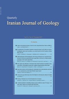
• List of Articles


      • Open Access Article

        1 - Analysis of geochemical features of sabzevar dust, using Marble Dust Collector (MDCO)
        آرش امینی بهنام  شفیعی
        Dust is one of the atmospheric phenomena that has adverse environmental effects and consequences. In order to study dusts in Sabzevar, samples were collected at the end of each season in 1390. In this research, sampling containers were installed in 16 locations on t More
        Dust is one of the atmospheric phenomena that has adverse environmental effects and consequences. In order to study dusts in Sabzevar, samples were collected at the end of each season in 1390. In this research, sampling containers were installed in 16 locations on the roofs of houses and governmental offices based on the main and sub geographical directions and trapped samples in MDCO were measured by 0.0001 accuracy scale. For geochemical studies due to the volume of dust collected and the importance of the samples, basic oxides and trace elements of fine dust were measured using atomic absorption and ICP methods. Results has shown that the maximum dust volume were collected in the spring while the concentration of most polluting elements is higher in autumn. In terms of pollution, Cadmium and Zinc are of primary importance in sabzevar due to their very high pollution coefficient. Chromium and Nickle are of secondary importance with being in the range of moderate pollution and significant pollution coefficient. In the current situation, the pollution of elements such as copper, lead and arsenic in the dust of Sabzevar is not critical and worrying. Manuscript profile
      • Open Access Article

        2 - The application of Normalized Cumulative Gamma Deviation Log (NCGDL) in sequence stratigraphic analysis and correlation, a case study from the Sarvak Formation, Abadan Plain, SW, Iran
        A. Asaadi A. Imandoust J.  Honarmand ایرج عبدالهی فرد O.R. Salmian
        Identification of key sequence stratigraphic surfaces is an essential task in geological evaluation of hydrocarbon reservoirs. The Sarvak Formation with Late Albian-Early Turonian age constitute the important reservoir unit in the Abadan Plain region, SW Iran. This stud More
        Identification of key sequence stratigraphic surfaces is an essential task in geological evaluation of hydrocarbon reservoirs. The Sarvak Formation with Late Albian-Early Turonian age constitute the important reservoir unit in the Abadan Plain region, SW Iran. This study investigates the application of Normalized Cumulative Gamma Deviation Log (NCGDC) to discriminate and correlate key sequence stratigraphic surfaces in six wells in a giant oil field in the Abadan Plain. To achieve this goal, identified key stratigraphic surfaces from core and thin sections were compared with interpretation of NCGDC method. From sequence stratigraphic point of view and based on the results from geological studies, the Sarvak Formation has been sub-divided into four third-order sequences which are described and interpreted. Two main disconformity surfaces, considered as sequence boundaries, are characterized by features of karstification, dissolution-collapse brecciation, and development of paleosol horizons. Generally, positive surfaces correspond to maximum flooding surfaces and negative surfaces occur at sequence boundary. Comparison of the results shows that, the identified sequence by NCGDC method can be effectively used for discrimination and correlation of sequences in different carbonate and siliciclastic reservoirs in the field scale. Manuscript profile
      • Open Access Article

        3 - Lithostratigraphy and biostratigraphy of the foram and diatome layers equivalent deposits based on calcareous nannofossils in the Gorgan Plain: A reference to evolution and paleogeography of the South Caspian Basin
        M. Sharafi N. Mousavi M. Moradpour B. Beiranvand A. Bayet-Goll F. Taati
        Paleocene-Miocene sediments in the central part of the Gorgan Plain were studied to evaluate lithostratigraphy, biostratigraphy and reconstruction of the paleogeography of the South Caspian Basin (SCB). Based on nannofossils distribution in the studied interval, the fol More
        Paleocene-Miocene sediments in the central part of the Gorgan Plain were studied to evaluate lithostratigraphy, biostratigraphy and reconstruction of the paleogeography of the South Caspian Basin (SCB). Based on nannofossils distribution in the studied interval, the following points were identified: Foram layers equivalent sediments have Thanetian –Eocene age and Upper Maykop- Diatom equivalent sediments have Middle-Late Miocene age. Evaluation of the nannofossils distribution in the studied interval has clarified a major unconformity between lower Paleocene-Eocene sediments and the upper Middle-late Miocene sediments. This unconformity is coincident with collisional event of the Afro-Arabia and Eurasia Plates and rising of the surrounding mountain ranges around the Caspian Basin including Alborz and Kopet-Dagh Mountains. Nannofossils distribution of the studied succession displays that the SCB was connected to the Black Sea and Mediterranean Basin in the lower Middle Miocene and was isolated in the Middle-Late Miocene. The interpreted east-west running seismic lines displays a clear increase in the sediment thickness and accommodation space from eastern to western part of the Gorgan Plain. The higher available accommodation space from east to west of the Gorgan Plain led to a delay in the subaerial exposure in the western part of the Gorgan Plain due to rising of the Kopet-Dagh and Alborz Ranges. This interpretation is consistent with the lack of the Paleocene-Eocene sediments and presence of the Cretaceous sediments below the major unconformity in the eastern part of the Gorgan Plain and presence of the Paleocene-Eocene sediment below the unconformity in the studied area. Manuscript profile
      • Open Access Article

        4 - Facies analysis and sedimentary environment of the Jeirud Formation in Garmabdar section, central Alborz: with emphasis on paleoredox conditions during deposition of black shales
        Nahid Karimi Najmeh  Etemad-Saeed Aram Bayet-Goll Afshin  Zohdi Tomas Kumpan
        The late Devonian has been associated with major global climate changes, widespread anoxia events, and the Hangenberg Crisis. The main aim of this study is to explore the relationship between paleoenvironment and paleoredox condition during deposition of the lower Devon More
        The late Devonian has been associated with major global climate changes, widespread anoxia events, and the Hangenberg Crisis. The main aim of this study is to explore the relationship between paleoenvironment and paleoredox condition during deposition of the lower Devonian Jeirud Formation in the Garmabdar section, northeast of Tehran. The Jeirud Formation in the Garmabdar section, with a thickness of about 280 m, is composed of siliciclastics, carbonates, carbonate-siliciclastic hybrids and phosphorite deposits. Sedimentary facies analysis led to recognition of three siliciclastic facies associations related to estuarine environments under the influence of waves, shoreface and offshore and two carbonate facies associations related to intertidal and subtidal environments. Moreover, the geochemical paleoredox proxies (such as U/Th and V/Cr) also suggest prevailing anoxic conditions during deposition of black shales and phosphorites in the studied section. In overall, these results suggest that there is a good agreement between the depth of the depositional environment and anoxic conditions during deposition of black shales of the Jeirud Formation. Manuscript profile
      • Open Access Article

        5 - Exploration analysis and determining the relationship between mineralization and faults as a new exploration key in the Sirjan-Beshneh copper deposit
        Reza Ahmadi S.J. Hosseini Shahraki
        Sirjan-Beshneh copper deposit with 0.5 kilometer area is located in Kerman province 80 kilometers west of Sirjan city. The variety of exploration activities including remote-sensing, field traverses, geophysical explorations, surface explorations comprising surface samp More
        Sirjan-Beshneh copper deposit with 0.5 kilometer area is located in Kerman province 80 kilometers west of Sirjan city. The variety of exploration activities including remote-sensing, field traverses, geophysical explorations, surface explorations comprising surface sampling and geochemical analysis of 94 samples, drilling and surveying three trenches with sampling and analysis of six samples as well as drilling of eight deep exploration borehole with the total length of 414.5 meter, have been carried out in the metallic deposit. All faults in the region were mapped based on the remote-sensing and structural geology operations of the region. In the present research, all exploration activities carried out in the Beshneh copper deposit were analyzed through investigating their relationship with the faults in the region. To achieve this goal, various techniques including drawing rose-diagram of faults, processing of resistivity and chargeability data of rectangle survey and smoothed inversion of data for five dipole-dipole profiles, imaging isograde maps for the surface and trench samples as well as 3-D modeling of exploration boreholes assays of the region were employed. The results showed that locations of mineralization related to the fractures and faults present in the region since the trend of most mineralized veins is along the main faults. At the end, in order to complete the explorations of the previous stages to get a better recognition of the deposit, drilling of several new exploration boreholes was proposed based on all performed studies and integrating obtained results as an exploration key.. Manuscript profile
      • Open Access Article

        6 - Carbon and oxygen stable isotope study of the Majdar travertine deposits, southeast of Ardabil
        َAli Lotfi Bakhsh
        Freshwater carbonates differ from each other according to isotopic geochemical properties. The study of carbon and oxygen stable isotopes is one of the most important study tools for carbonates, including travertine deposits. In Majdar area, which is located in the west More
        Freshwater carbonates differ from each other according to isotopic geochemical properties. The study of carbon and oxygen stable isotopes is one of the most important study tools for carbonates, including travertine deposits. In Majdar area, which is located in the western Alborz-Azerbaijan tectonic zone, Quaternary travertine deposits are located in the Eocene porphyry andesite volcanic units. Based on mineralogical studies, travertines are mainly composed of aragonite. The mean values of δ13C and δ18O isotopes of travertines in the study area are + 6.47 and -8.77, respectively, which indicates the thermogenic origin of travertines. Also, the mean value of δ13C (CO2) is -2.73, which suggests an inorganic and endogenic origin for CO2. It is thought that CO2-rich hydrothermal fluids have provided the calcium bicarbonate ions needed to form travertine after circulation within the calcareous unit in the area and reacting with it. Then, these fluids ascended through the fault systems and deposited travertine on the surface. Manuscript profile
      • Open Access Article

        7 - Petrology of alkaline lavas in North Jirandeh (East of Lushan)
        A. Soleimani Sh. Haghnazar M Vosoughi Abedini S. Hakimi Asiabar
        In the north of Jirandeh and east of Lushan, which are located in the mountains south of the central Alborz, a series of volcanic rocks are unconformablly located on the Middle Eocene limestone. These rocks have alkaline affinity of different types of lamprophyre and ar More
        In the north of Jirandeh and east of Lushan, which are located in the mountains south of the central Alborz, a series of volcanic rocks are unconformablly located on the Middle Eocene limestone. These rocks have alkaline affinity of different types of lamprophyre and are studied for the first time from the petrology point of view. The texture of these rocks is porphyric to microporphic with microlithic matrix. The phenocrysts and microphenocrysts of the collected samples are generally olivine, alkaline pyroxenes and biotite, which are located in olivine, pyroxene, plagioclase, amphibole, very fine nepheline crystals, apatite and metal ores groundmass. Geochemical studies of these rocks indicate that these rocks are alkaline lamprophyres and the magma is the result of partial melting of an asthenospheric mantle source similar to OIB. They are classified in garnet lherzolite facies and were emplaced in an intercontinental rift tectonic environment. Manuscript profile
      • Open Access Article

        8 - A suitable algorithm for identifying changes in micro-landforms using UAV images. Case study: Barg-e- Jahan area in Jajrud region (2015-2016)
        M.H. Tavakol M. Ghahroudi H. Sadough Kh. Alinoori
        One of the main and most important topics of geomorphology is the identification and evaluation of microlandform changes. Their recognition and spatial distribution in order to understand and evaluate changes, stability studies and regional planning is one of the basic More
        One of the main and most important topics of geomorphology is the identification and evaluation of microlandform changes. Their recognition and spatial distribution in order to understand and evaluate changes, stability studies and regional planning is one of the basic needs of applied geomorphology. Barg-e- Jahan area is located in Jajroud catchment area affected by many environmental changes. In this study, based on micro-scale geomorphological approach, using UAV images along with field survey in the Barg-e- Jahan area, microlandforms changes were investigated. UAV images with a spatial resolution of 2.5 cm were obtained from the Ministry of Energy between 2015 and 2016. These images were corrected using ENVI 5.1 and Arc Map 10.3 software, and then the desired algorithms were implemented via coding in Python. Changes were investigated with machine learning algorithms and random forest models, SVM with RBF kernel, random forest with features extracted from CNN networks, and SVM with linear kernel with features extracted from deep neural networks. Results showed that the SVM-RBF model is less accurate than other models with 88% accuracy, so the separation between the classes was limited. In the random forest, 92% of the classes were distinguishable with linear boundaries. The near-ideal model in the random forest algorithm with deep learning was observed with an accuracy of 96%. Investigations showed that most of the changes in microlandforms in this model were related to the change of vegetation cover to soil by 45.03%, and in the next place, the change of sheet wash erosion by 22.05%. According to the obtained results and field observations in 2017, it was determined that the flood of 2017 in Barg-e-Jahan area has caused major changes in the area. Its greatest impact was on the vegetation and the diagram shows at the highest degree of disturbance. In this period, the surface flow and gully formation in the area increased and it shows the high level of erosion and great changes of microlandforms in the study area. Manuscript profile