• List of Articles


      • Open Access Article

        1 - بلثق
        برث
      • Open Access Article

        2 - یسب
      • Open Access Article

        3 - fd
      • Open Access Article

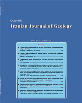
        4 - Petrology and geochemistry of igneous rocks in Lower Red Formation, Garmsar Area
        Habibollah Ghasemi
        Numerous shallow depth basic intrusions crops out in the Lower Red Formation in Garmsar area. These intrusions have gabbro-dioritic compositions and granular, intergranular, ophitic and subophitic textures. Plagioclase, augitic clinopyroxene, amphibole and biotite are t More
        Numerous shallow depth basic intrusions crops out in the Lower Red Formation in Garmsar area. These intrusions have gabbro-dioritic compositions and granular, intergranular, ophitic and subophitic textures. Plagioclase, augitic clinopyroxene, amphibole and biotite are their main minerals and olivine, phlogopite, alkali feldspar, apatite, magnetite and sphene are their minor and accessory minerals. Their secondary minerals composed of serpentine, zeolite, chlorite, sericite, prehnite, sphene, uralite, quartz and calcite. These rocks plotted in gabbro-diorite realm in chemical classification diagrams. Geochemical trends of samples in major and trace elements variation diagrams versus differentiation index and in incompatible-incompatible and incompatible-compatible diagrams indicate the liquid line of descent and differentiation relations between samples. In the chondrite and primitive mantle normalized diagrams, enrichment in LREEs and LILEs, depletion in HREEs, absence of Eu anomaly, positive anomalies in K, Ba, Rb and Sr in all samples and strongly depletions in Nb and Ta in some samples and absence of depletion in Ti and P, are the characteristics features of these rocks. This indicates the crustal contamination of the mafic mantle magma formed these rocks. These rocks rather have the features of proto-back-arc basin (BAB) alkaline basaltic magmas, not the characteristics of the subduction related rocks. The dependence of these rocks to the back-arc basin basalts can be confirmed by different tectonic setting discrimination diagrams. It seems that the primary basic magma of these rocks has been generated from partial melting of an enriched mantle source under the continental lithosphere of Central Iran in an extensional proto-back-arc basin, during Late Oligocene time and intruded in lower part of Lower Red Formation. Manuscript profile
      • Open Access Article

        5 - A comparison of Calculated Fixed Radius and Numerical Model Methods to delineate drinking water wellheads protection area in Yaft Abad district, Tehran
        بهزاد  دلخواهي
        Delineation of wellhead protection area is an important component of groundwater protection strategies to prevent probable environmental and health hazards. In this study, besides describing the calculated fixed radius (CFR) and the numerical model methods to determine More
        Delineation of wellhead protection area is an important component of groundwater protection strategies to prevent probable environmental and health hazards. In this study, besides describing the calculated fixed radius (CFR) and the numerical model methods to determine the wellhead protection area, in order to compare of the methods, were used from data of eight number of drinking water wells in Yaft Abad district of Tehran. For this purpose, overlapping rate of CFR and numerical model protection areas in GIS environment were analyzed. The overlapping results show increasing distance from the wells, the effectiveness and accuracy of CFR method decreases rapidly. In the 50 days time of travel overlay, 88 percent of the numerical model areas are captured by the CFR areas. While in the 10 years overlay, only 41 percent of the numerical model areas are captured by the CFR areas. When time, money and data are limited, the Calculated Fixed Radius method is an acceptable method only to delineate the 50 days time of travel protection areas. Manuscript profile
      • Open Access Article

        6 - Estimating the rate of salt dissolution of Iranian salt diapirs, the Konarsiah Diapir
        مهدی  زارعی
        There are more than 100 exposed salt diapirs in southern Iran. These salt diapirs are of the most probable sources of salinity in this area and deteriorate the quality of surface and groundwater resources in many cases. About 90 Km south of Shiraz, the Konarsiah salt di More
        There are more than 100 exposed salt diapirs in southern Iran. These salt diapirs are of the most probable sources of salinity in this area and deteriorate the quality of surface and groundwater resources in many cases. About 90 Km south of Shiraz, the Konarsiah salt diapir influences the adjacent aquifers and its brine discharges into the Firouzabad River. In order to estimate the Rate of Konarsiah salt dissolution, total dissolve solid, the concentration of major ions including sodium and chloride were measured in 17 springs, 2 boreholes, 5 exploitation wells and 8 surface water sampling monthly for a period of a hydrological year. In addition, discharge and the concentration of sodium and chloride were measured every two hours during a flood event in the studied year. Using these data, the total mass of salt dissolved from the Konarsiah salt diapir was calculated equal to 146539 tons during the studied year. The main part of this salt, 143269 tons is being dissolved as base flow during the year while the remaining 3272 tons (about 2 percent) dissolves during flood conditions. The rate of total salt dissolved is equal to 1.8 mma-1, which is different from those reported by other researchers. The reasons for these differences are discussed here. Finally, a few remediation methods are proposed to decrease the influence of the Konarsiah salt diapir on the adjacent aquifers and surface water. Manuscript profile
      • Open Access Article

        7 - Check of the hydrocarbon potential of Ilam, Lafan and Sarvak formations in The Nusrat Oil Field in SE Persian Gulf: Using Rock Eval Pyrolysis VI and gas chromatography (GC)
        Mohammad صادقی
        The best tools and methods in geochemical evaluation of source rocks are Rock-Eval Pyrolysis and Gas Chromatography. In this study, in order to evaluate geochemical characteristics of Ilam, Laffan and Sarvak formations in well NH01 in Nosrat Oil Field, geochemical dat More
        The best tools and methods in geochemical evaluation of source rocks are Rock-Eval Pyrolysis and Gas Chromatography. In this study, in order to evaluate geochemical characteristics of Ilam, Laffan and Sarvak formations in well NH01 in Nosrat Oil Field, geochemical data including preliminary and detailed Rock Eval Pyrolysis, bitumen extraction and Gas Chromatography on 15 cuttings samples (7 samples from Ilam, 6 samples from Laffan and 2 samples from Sarvak formations) were used. Results of pyrolysis indicated that most samples have a mixture of kerogen type II and III that often tend to be kerogen type II. In general, Ilam, Laffan and Sarvak formations are poor in organic matter and have lower hydrocarbon potential and maturities. Results of liquid chromatography for Ilam and Sarvak samples indicated that these samples are paraffinic in origin. Gas chromatography suggested that Ilam and Sarvak formations deposited in anoxic conditions containing organic matter mostly derived from marine environment with subordinate amounts of terrestrial input. Manuscript profile
      • Open Access Article

        8 - Study of the major and rare earth elemens behavior during hydrothermal alteration in the Yanigh area (SW Hashtroud, East -Azarbaijan)
        The study area is located about 27 Km southwest of Hashtroud City around the Yanigh village. This district is a part of western Alborz-Azarbaijan structural zone. In the study area, volcanic rocks with andesite to basaltic andesite composition have shown relatively inte More
        The study area is located about 27 Km southwest of Hashtroud City around the Yanigh village. This district is a part of western Alborz-Azarbaijan structural zone. In the study area, volcanic rocks with andesite to basaltic andesite composition have shown relatively intense argillic alteration. Geochemical studies and mass change calculations on the major and minor elements in the altered zone show that Fe, Mg, Ca and Mn are depleted, Na and K slightly enriched and Al and Si strongly enriched in altered rocks relative to the initial rocks. The HFSEs, LILEs and LREEs show enrichment but the TTEs and HREEs and Y show depletion during alteration. Eu/Eu* ratio in the altered rocks is more than unaltered rock and the majority of samples show positive Ce anomalies. In addition, fractionation factors, (La/Yb)n and (La/Sm)n in the altered rocks is more than, and (Gd/Yb)n is lower than unaltered rock. Manuscript profile
      • Open Access Article

        9 - Assessing the risk of erosion and sedimentation potential of watershed of Shahriar Dam in Mianeh Using GIS techniques and EPM Model
        mohammad hosein goudarzi
        Soil erosion and sedimentation are among the major limitations in applying water and soil resources. Thus, the assessment processes that govern their behavior in order to better understand watershed systems and explain proper management practices are essential. This stu More
        Soil erosion and sedimentation are among the major limitations in applying water and soil resources. Thus, the assessment processes that govern their behavior in order to better understand watershed systems and explain proper management practices are essential. This study is therefore aimed at studying erosion in the watershed of Shahriar Dam in Mianeh, East Azerbaijan Province. In view of the recent conditions of formations, a sedimentation rate is very high in this dam. Evidently, these sediments fill the dam reservoir and lead to a reduction of the dam life time. As a result, studying erosion and estimating upstream erosion and sedimentation are necessary. Consequently, one of the principal goals of this survey is determining the level of sensitivity of formations to erosion and their roles in formation of new sediments. To achieve this aim, the border of Shahriar Dam’s watershed was determined by using 1:50000 topographic maps of Zanjan, Mianeh and Hashtrood. This region was carefully implemented on 1:250000 geological maps of Zanjan, Mianeh and Hashtrood. Maps of channels, geology, vegetative cover, faults, amount of rainfall, and regional topography were digitalized. Next, the erosion intensity was examined in the above-mentioned basin using GIS and marking and layer integration methods. On the other hand, in order to estimate the rate of erosion of present formations in the watershed basin, EPM method was used. It was revealed in this study that erosion-sensitive units were largely located in the northern and southern areas of the basin; however, there are erosion-prone rocks in the western part too. Based on the existing indices of GIS, total amount of sedimentation of the watershed basin of Shahriar Dam is medium. Moreover, according to EPM model, the coefficient of erosion and sediment yield (z) for this basin fall into very heavy erosion classes. for this reason, the sediment yield in the basin was high and put at somewhere close to 60,000 tons per hectare annually; and according to the zoning map of erosion, much of the sediment comes from segments of the zoning was done in this research area erosional is placed high. The final model represents the fact that lithology, land cover and stream erosion play a major role in controlling erosion and sediment yield. Manuscript profile
      • Open Access Article

        10 - Geochemistry, microfacies and depositional environment of Eocene Deposit in Gach Mountain, in SE Lar Area
        محمد حسين  آدابي
        The Jahrum Formation in Gach Mountain, located near village of Chahar Berkeh, in 30 Km of south- east of Lar City, south- west of Iran (Zagros Basin). This formation with the total thickness of 404.5 m consists of dolomite, calcareous dolomite and limestone. This form More
        The Jahrum Formation in Gach Mountain, located near village of Chahar Berkeh, in 30 Km of south- east of Lar City, south- west of Iran (Zagros Basin). This formation with the total thickness of 404.5 m consists of dolomite, calcareous dolomite and limestone. This formation overlies the Sachun Formation. The Asmari Formation with the total thickness of 44.5 m consists of limestone and marly limestone, and covered by evaporite deposits of the Gachsaran Formation. The age of the Jahrum Formation is Late Paleocene to Late Eocene. Eocene deposit in Gach Mountain, based on different facies, foraminifera and other skeletal and non skeletal grains, 7 microfacies were recognized. These microfacies deposited in a carbonates ramp environment with ooid shoal deposits. Analysis of 30 samples of limestones and dolomites for major and minor elements (Ca, Mg, Fe, Mn, Na, and Sr) and oxygen and carbon isotope values were used for carbonate mineralogy, types of dolomites, and diagenetic system. This study indicates that Jahrum carbonates were deposited in a shallow warm water tropical environment and original carbonate mineralogy was aragonite. These carbonates were affected by close to semi close diagenetic system with low water/rock interaction. Diagenetic trend in limestones and dolomite, based on oxygen and carbon isotope variations, shows a burial diagenesis with the presence of origanic matter. Temperature calculation based on heaviest oxygen isotope values (-3.32% PDB) of micrite and δw of Eocene seawater of - 0.85 SMOW, indicate that very shallow burial temperature was around 23˚C. Sequence stratigraphic studies, shows that two depositional sequences, consisting of transgrassive system tract (TST) and highstand system tract (HST). This sequences, shows third order type, with sequence boundaries (SB2). Maximum flooding surface in the Jahrum Formation was determined based on different facies and variation of isotope values. Manuscript profile